
I was up early and packed, feeling super thankful I’d been able to get all my clothes washed at Andreea’s. I said goodbye to a friend I’m so fortunate to have met. Even though she was busy, I had ay great stay in Bristol and hopefully we can catch up again in the future.
I caught a bus out to Bristol Airport with the dread of flying Ryanair, having heard plenty of stories about them being unreliable. In the end, it all went well, and I arrived on time in Dublin with all my gear. I took a shuttle to the car hire place where I had a bone to pick with Thrifty over a bogus charge from my last rental in Ireland. I didn’t get it sorted, and it’s now sitting with their complaints department… I’ll not rant here. I ended up hiring a car with another company, got on the road, and waved farewell to Dublin.
It was quite the drive ahead of me, especially as I hadn’t been behind the wheel since my last time in Ireland. I arrived in the early evening at my accommodation near Killarney. I headed out for dinner, but the only place open was a Chinese takeaway in the small village of Milltown. The pub across the road was serving beers, so I waited there for my food before heading back to the guesthouse for a sleep. The Chinese food was quite good.
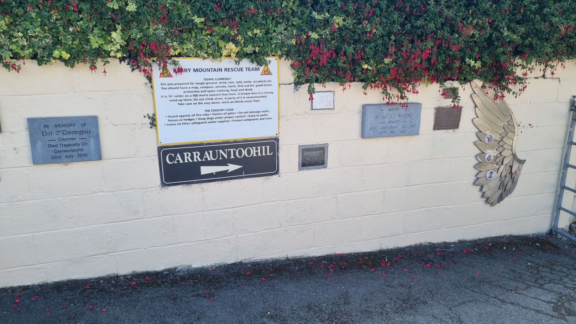
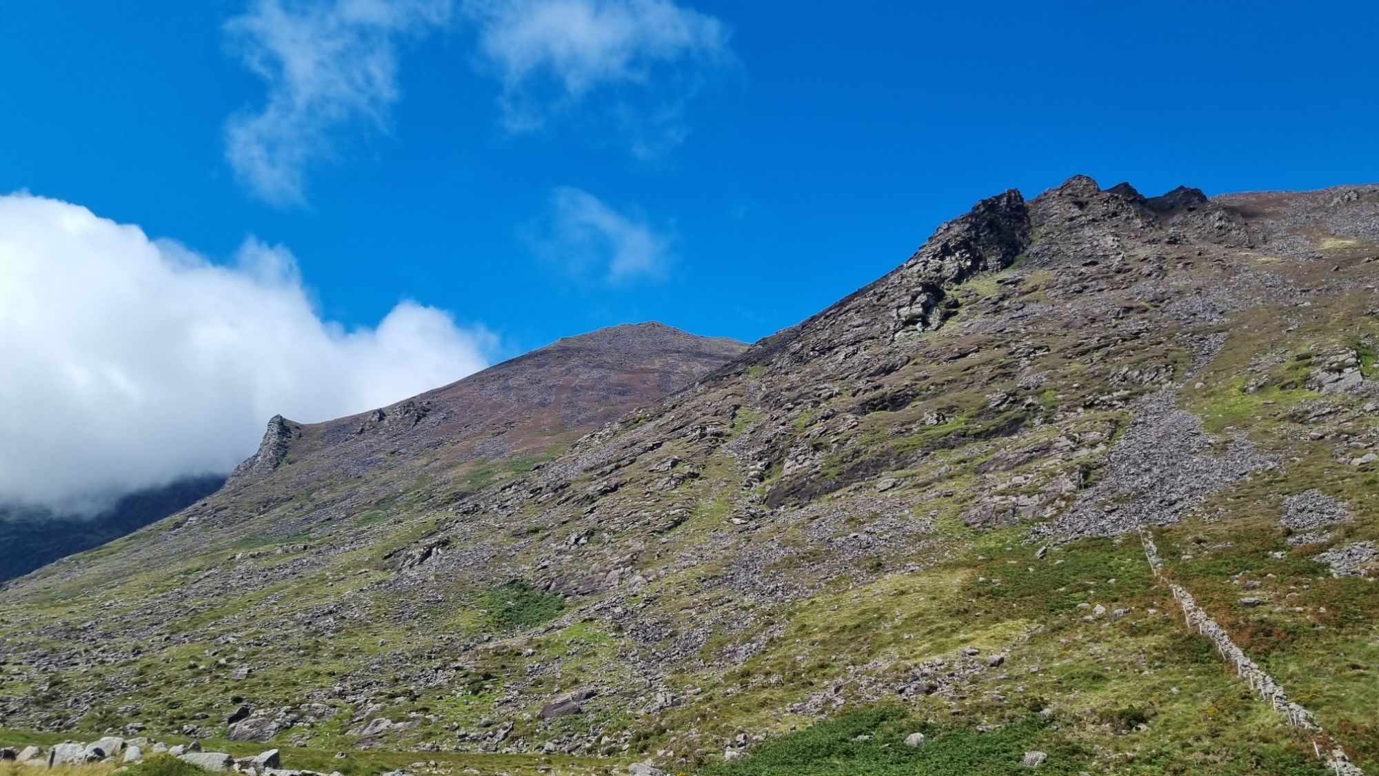
So far on my travels I’ve climbed a few mountains, namely Ben Nevis, the tallest peak in Scotland and the UK, and Snowdon, the tallest peak in Wales and third in the UK. I missed out on Scafell Pike, the tallest in England, but my sights were now set on Carrauntoohil, the tallest peak in Ireland and fifth in the UK/Ireland. Conveniently, it was on the way to my end destination: back to Portmagee.
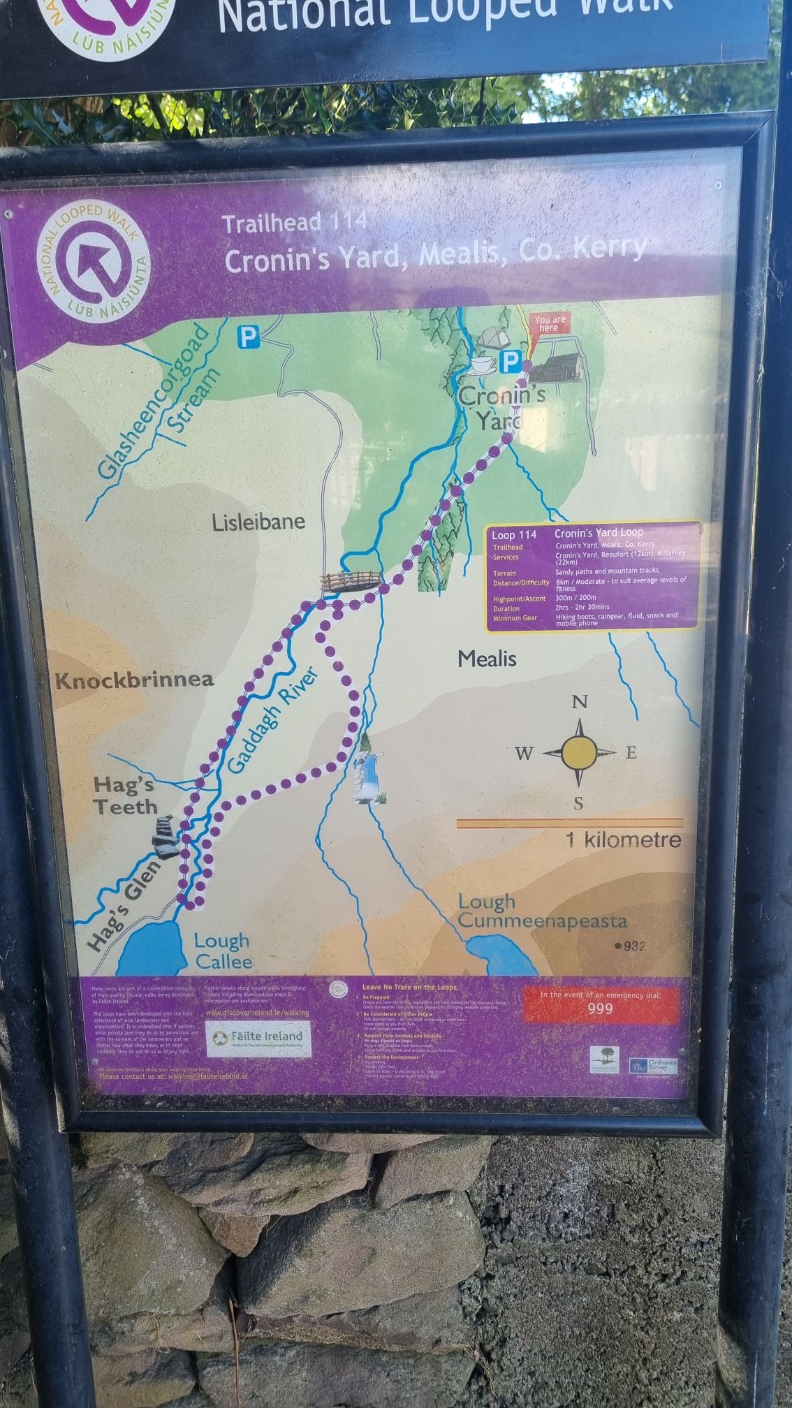
I drove out to the start of the hike, a place called Cronin’s Yard, which had a lovely café/gift shop/campground. It seemed to be a popular hike, and with it being a Sunday and the weather playing nice, the place was busy. I bought some sandwiches to enjoy at the summit and set off.
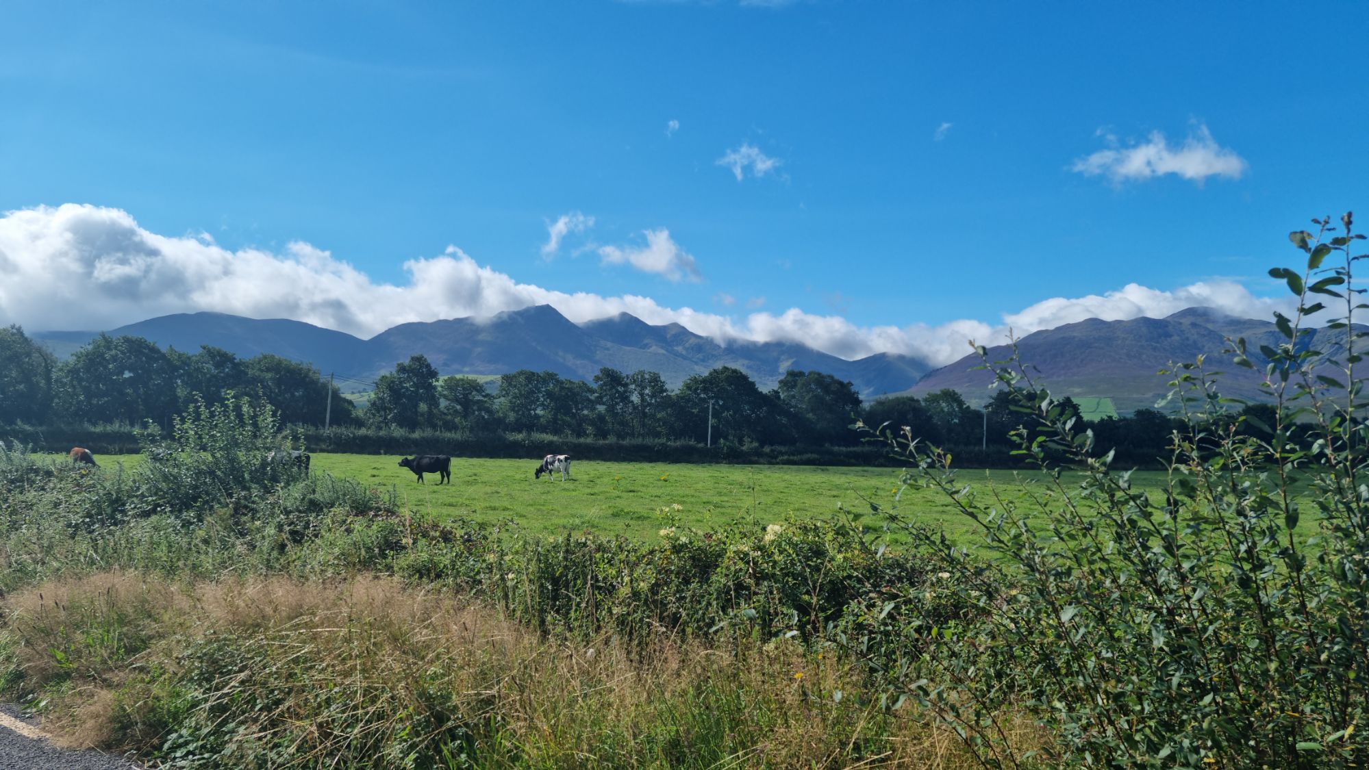
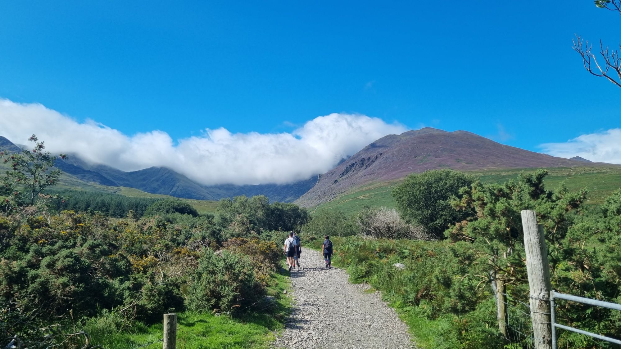
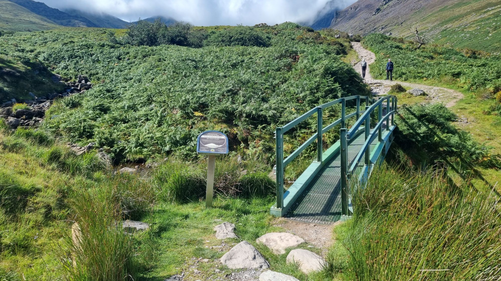
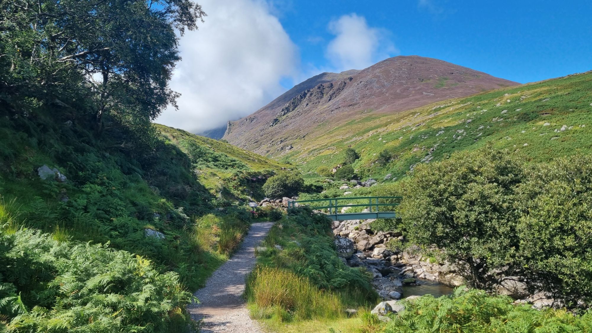
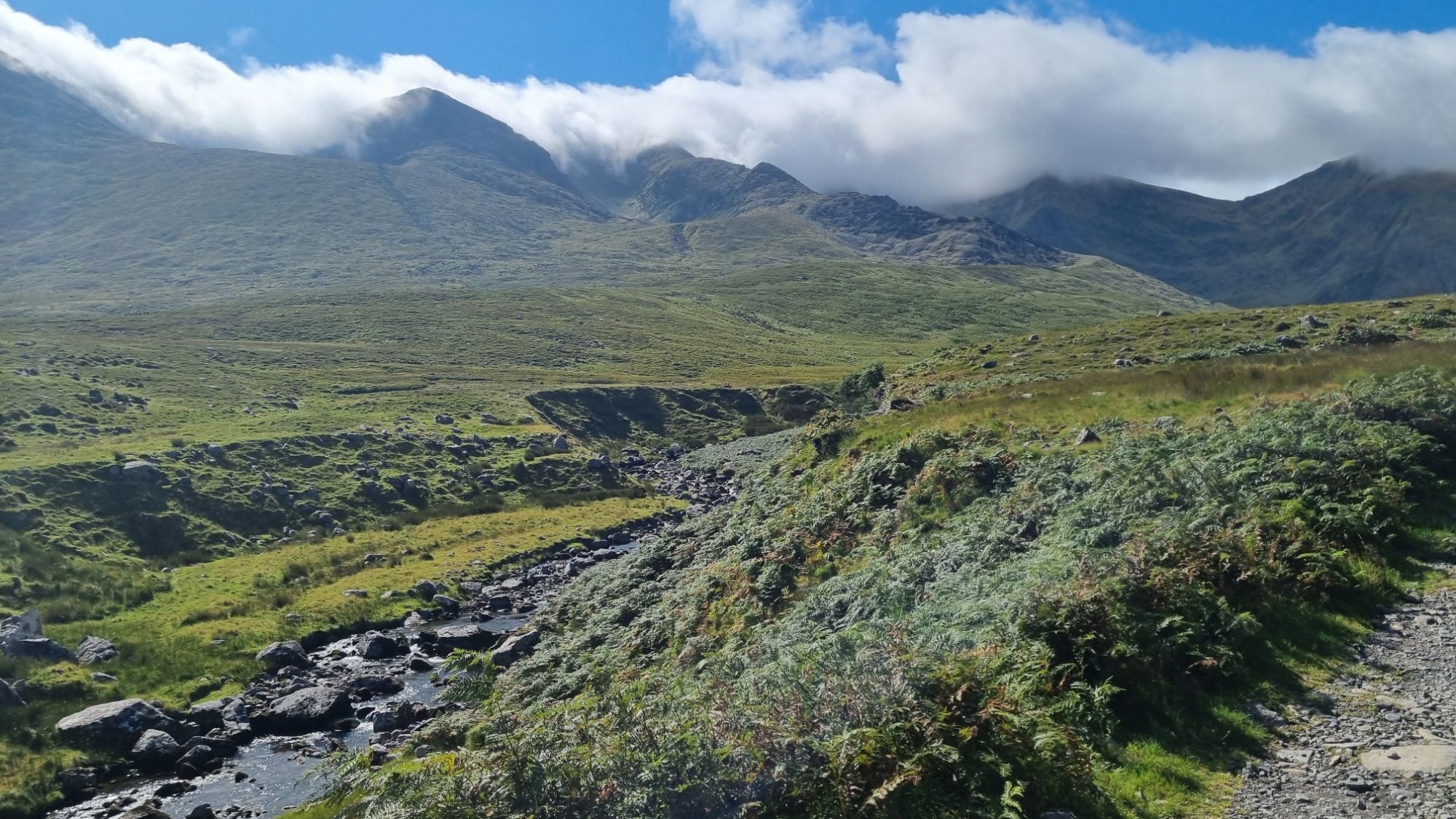
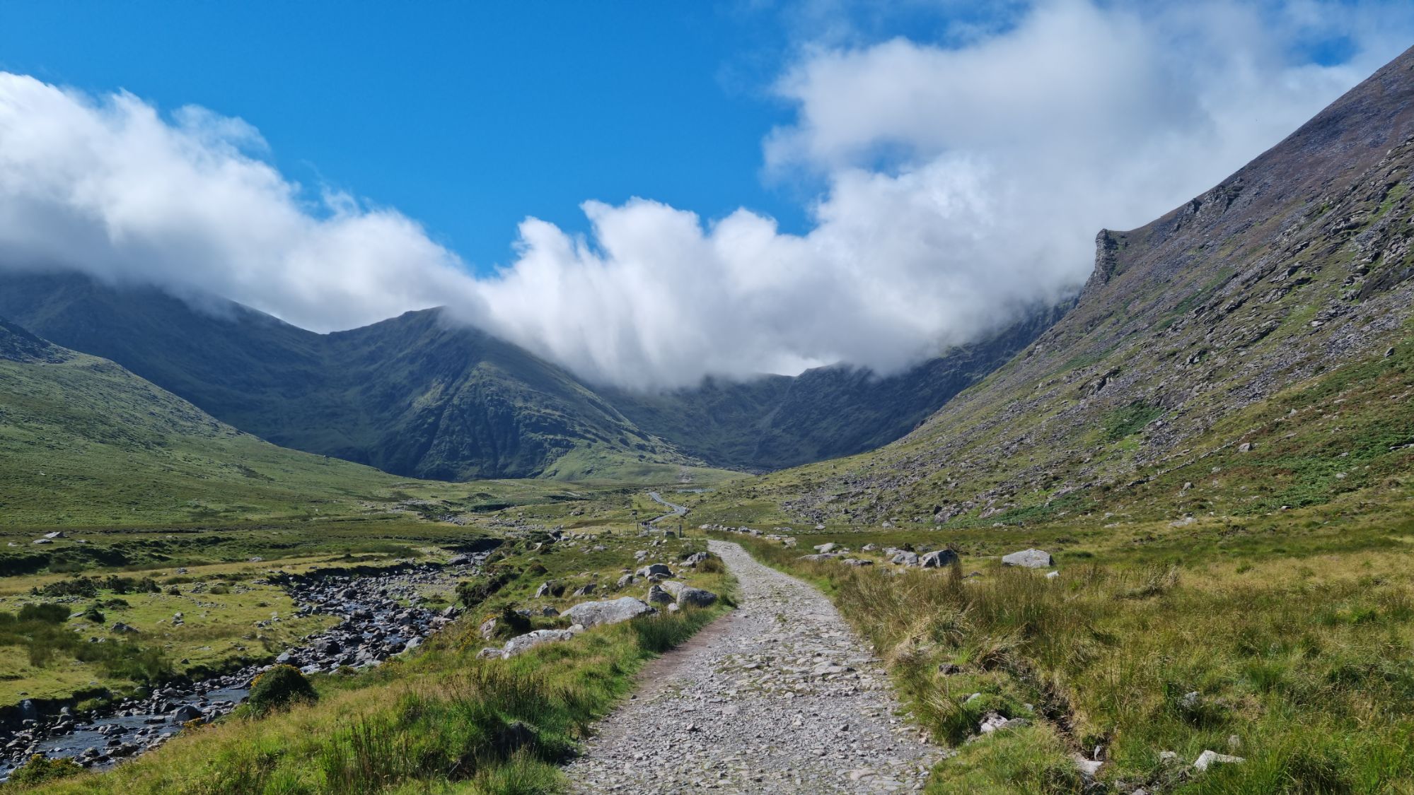
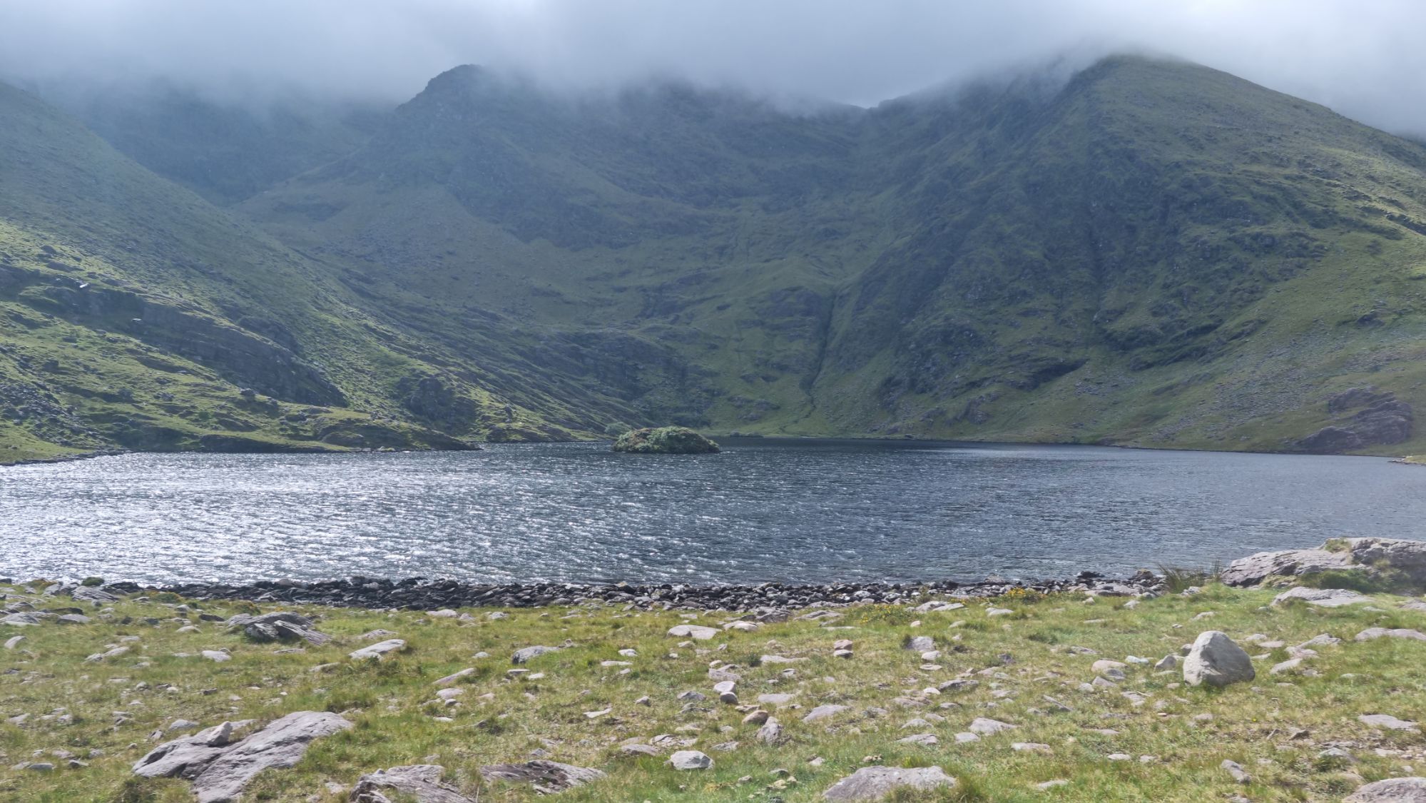
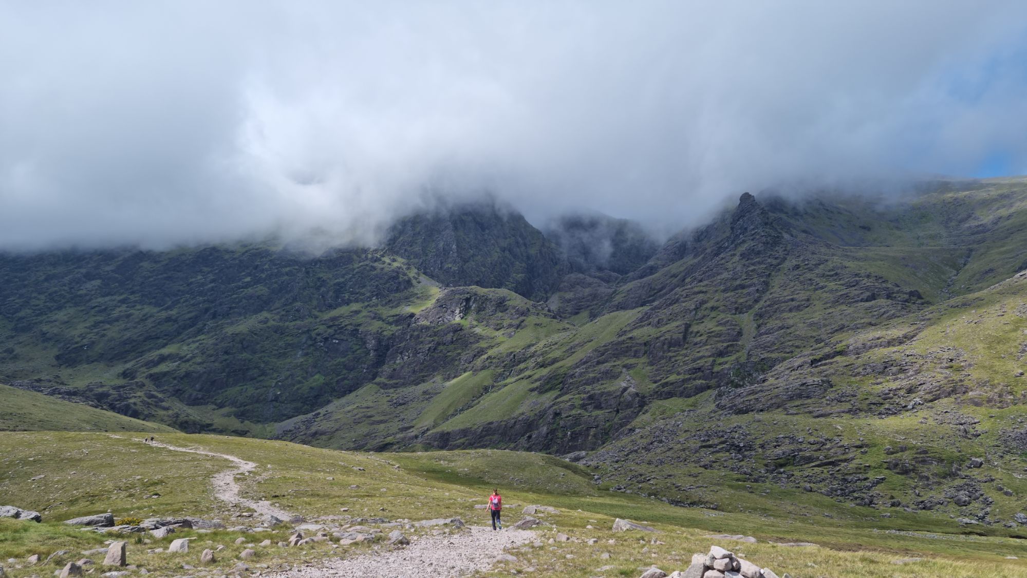
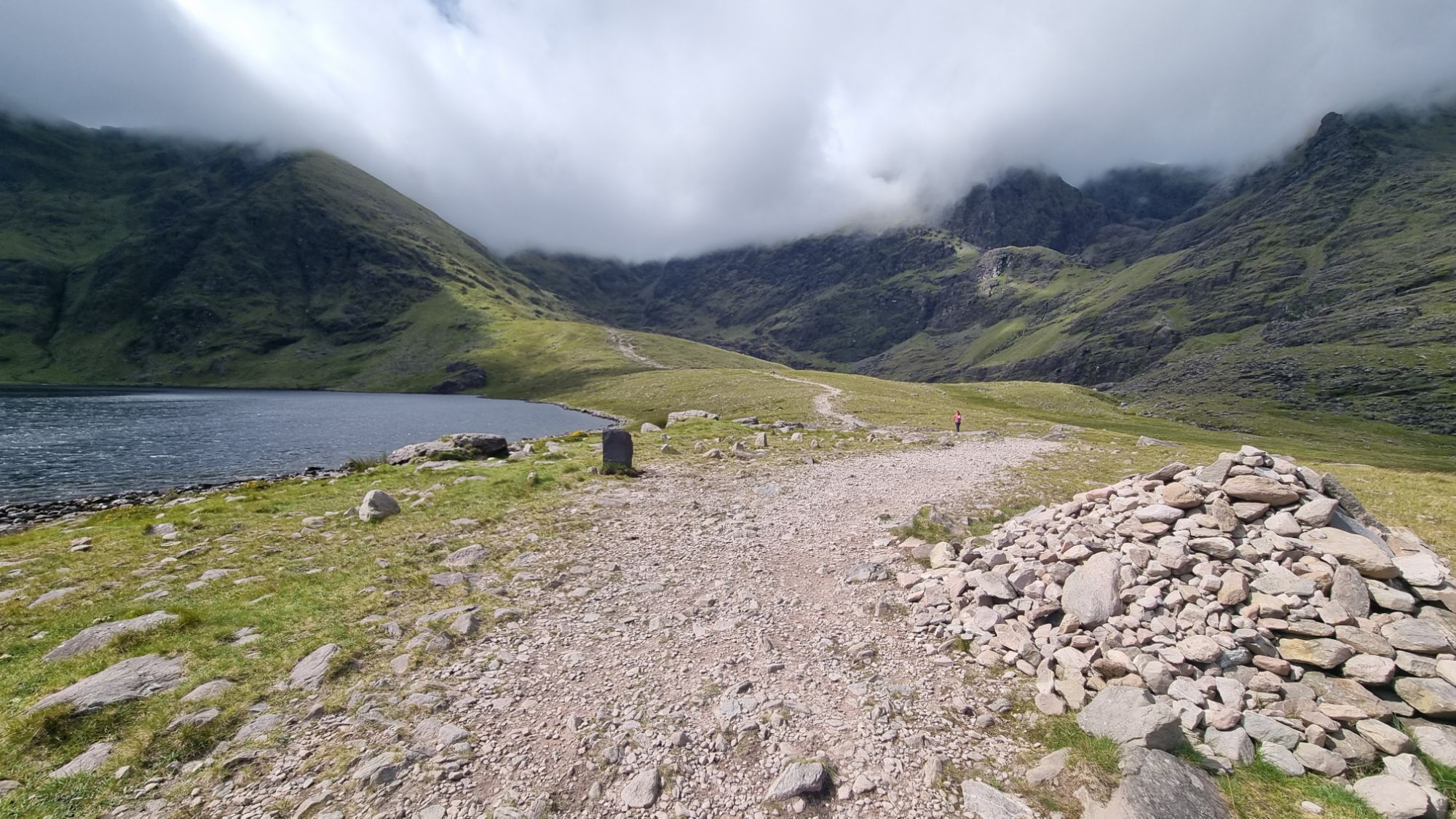
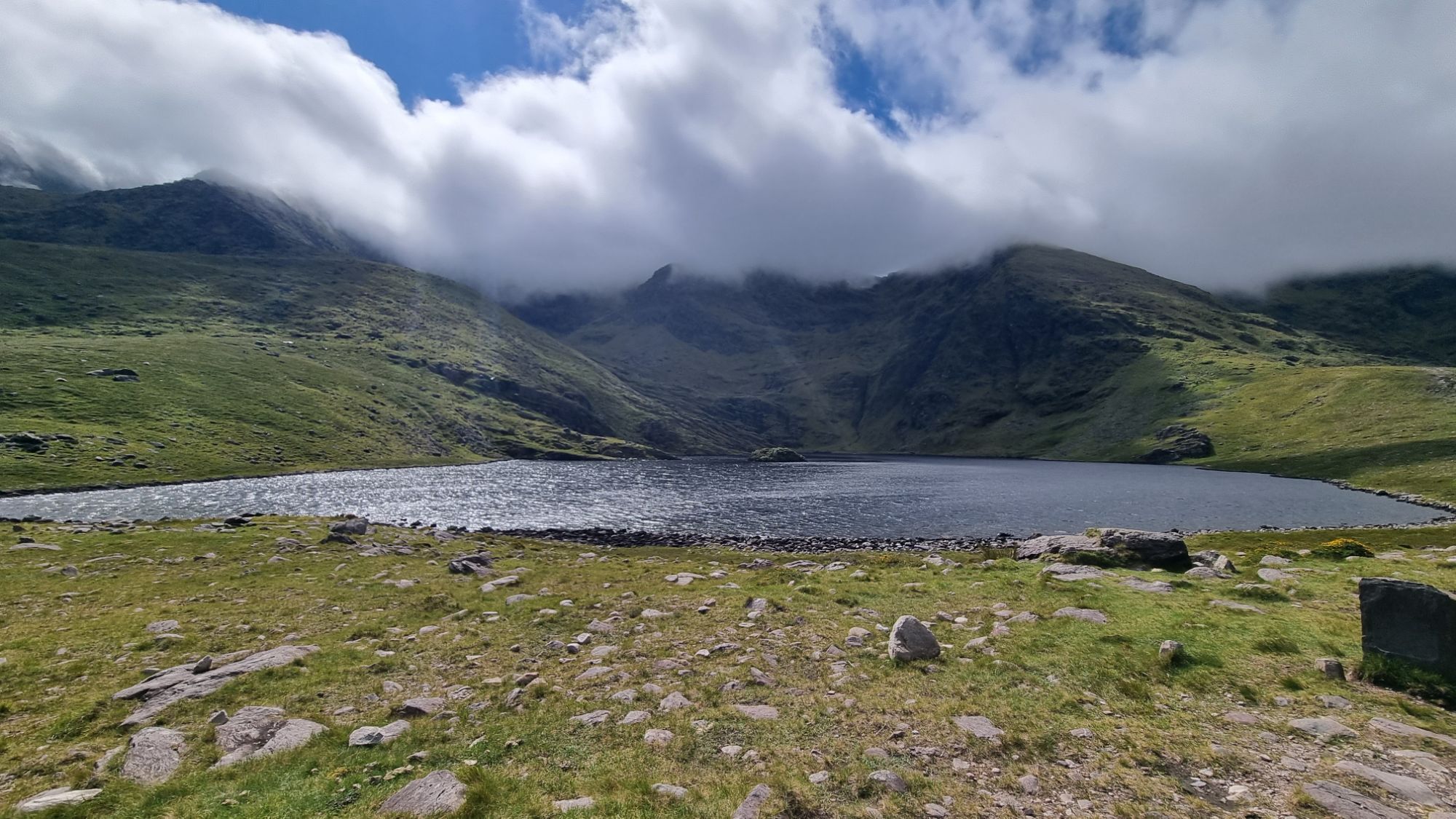
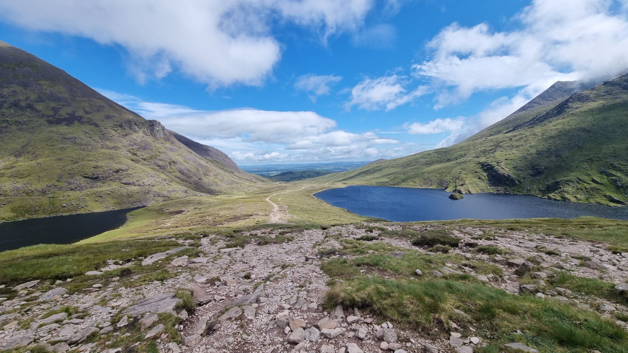
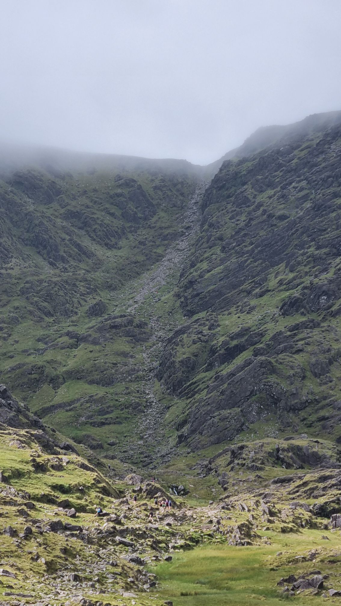
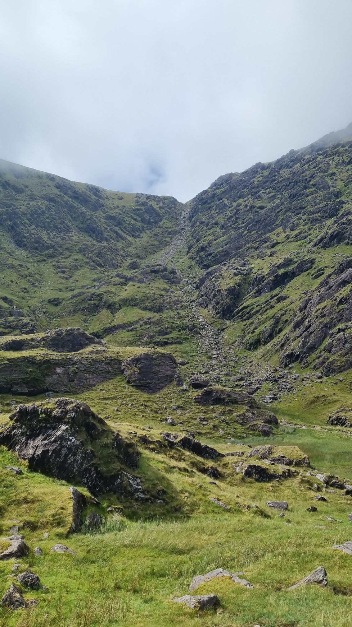
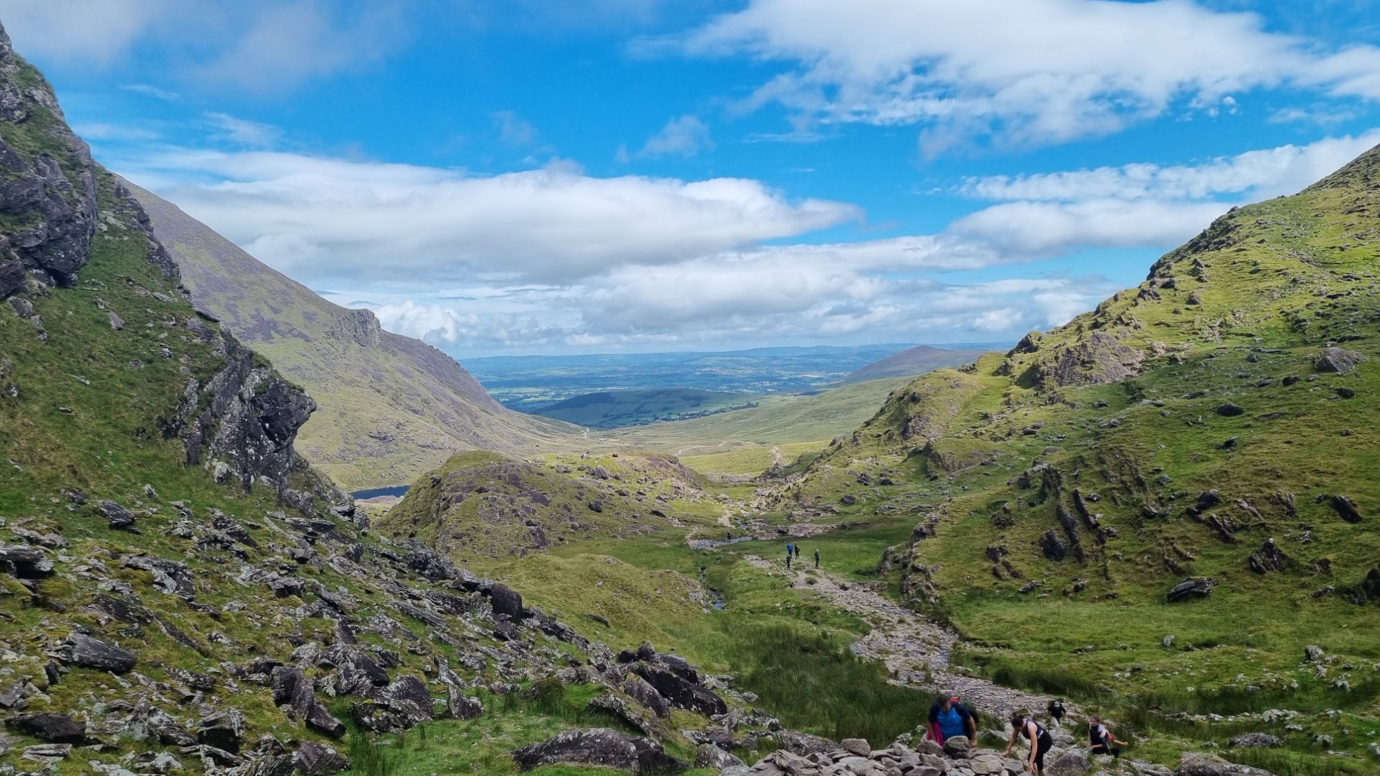
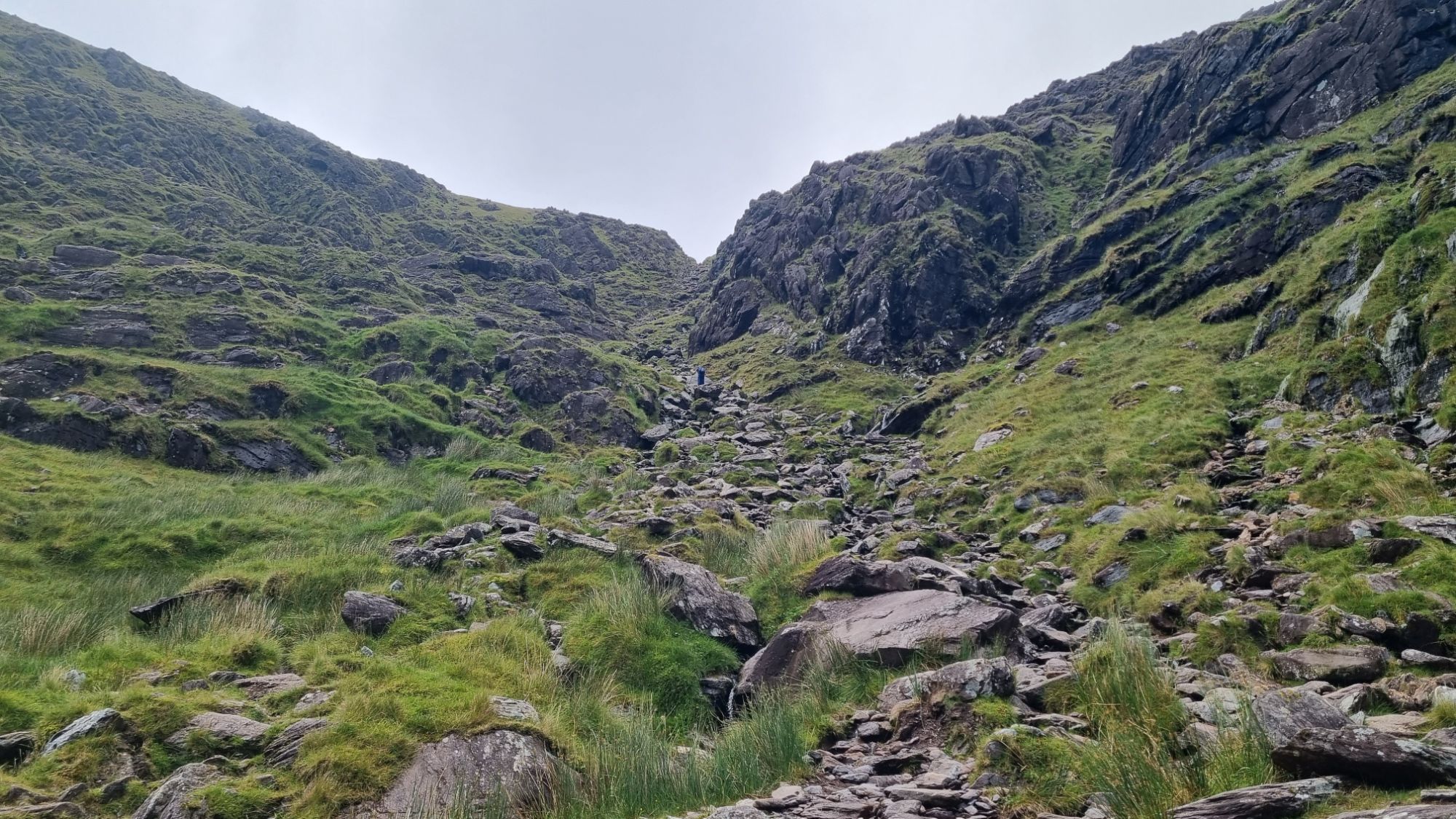
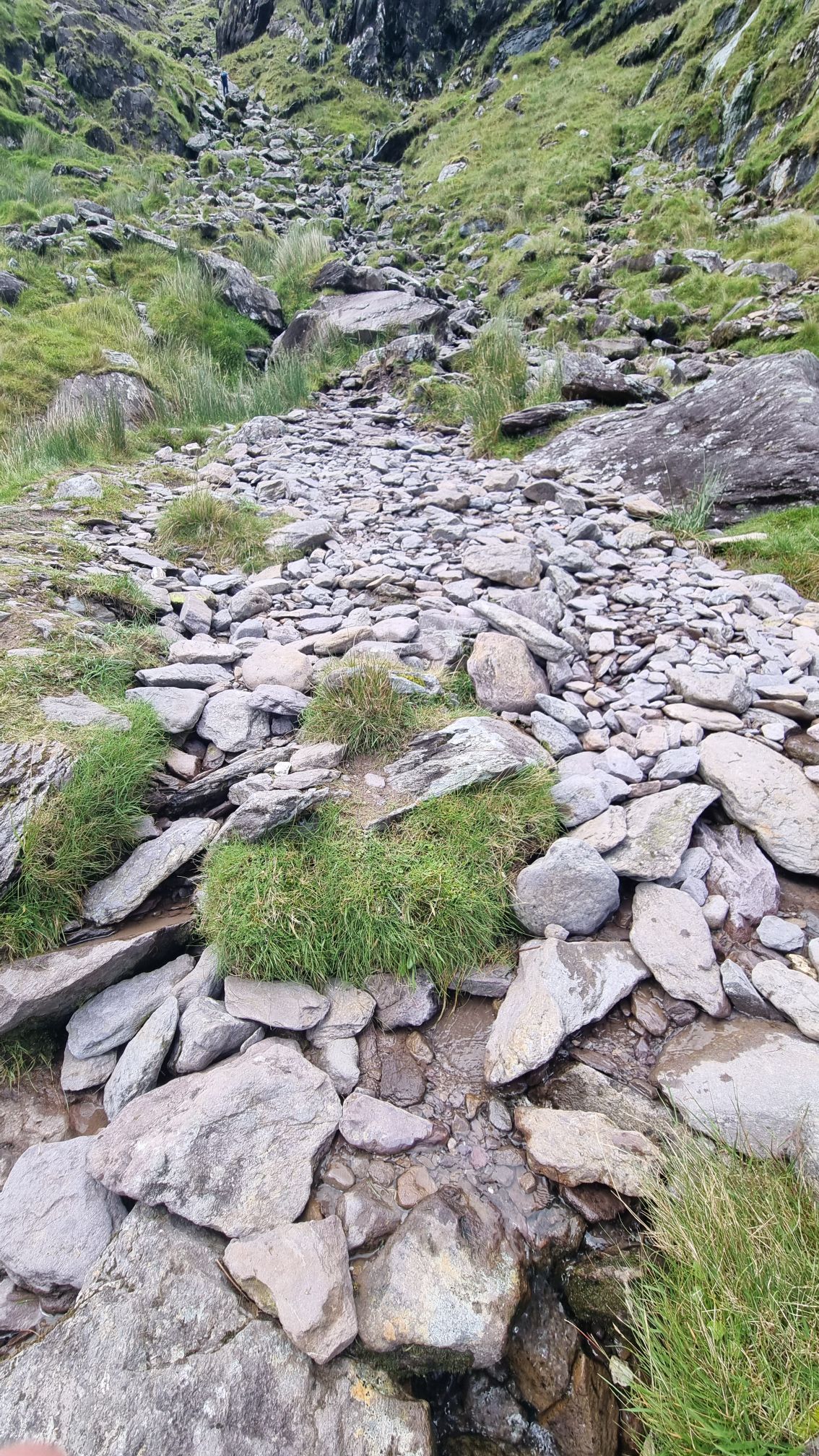
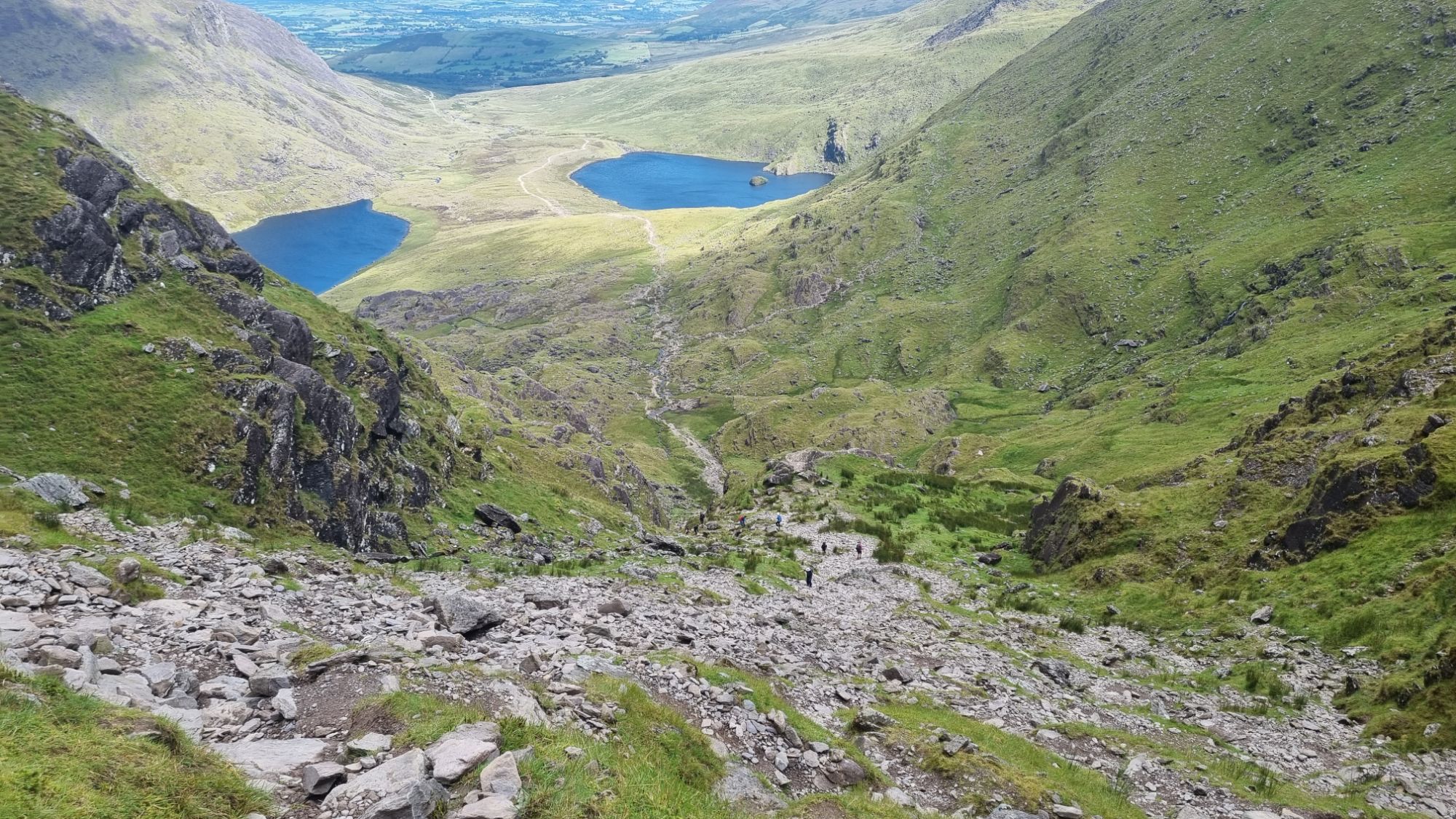
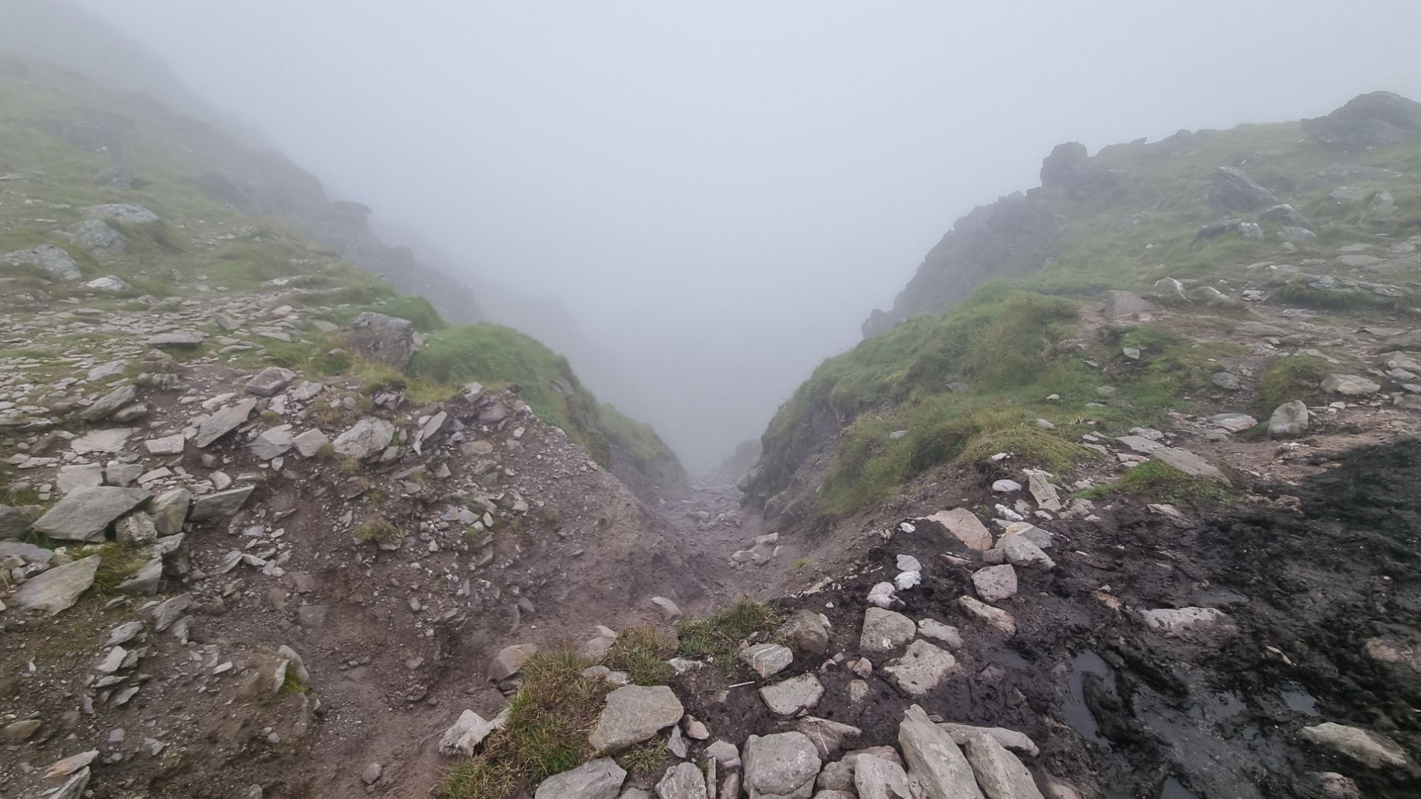
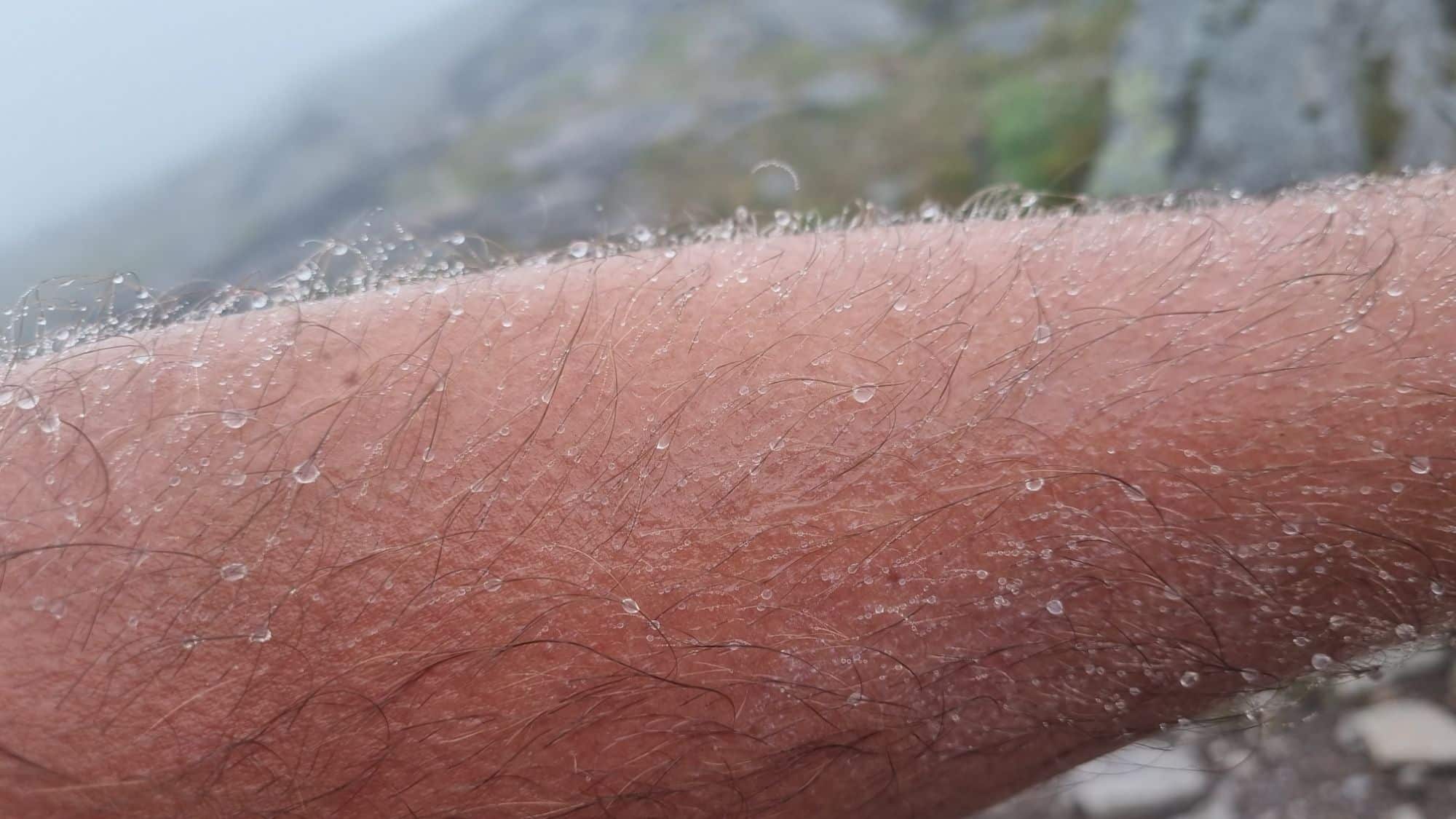
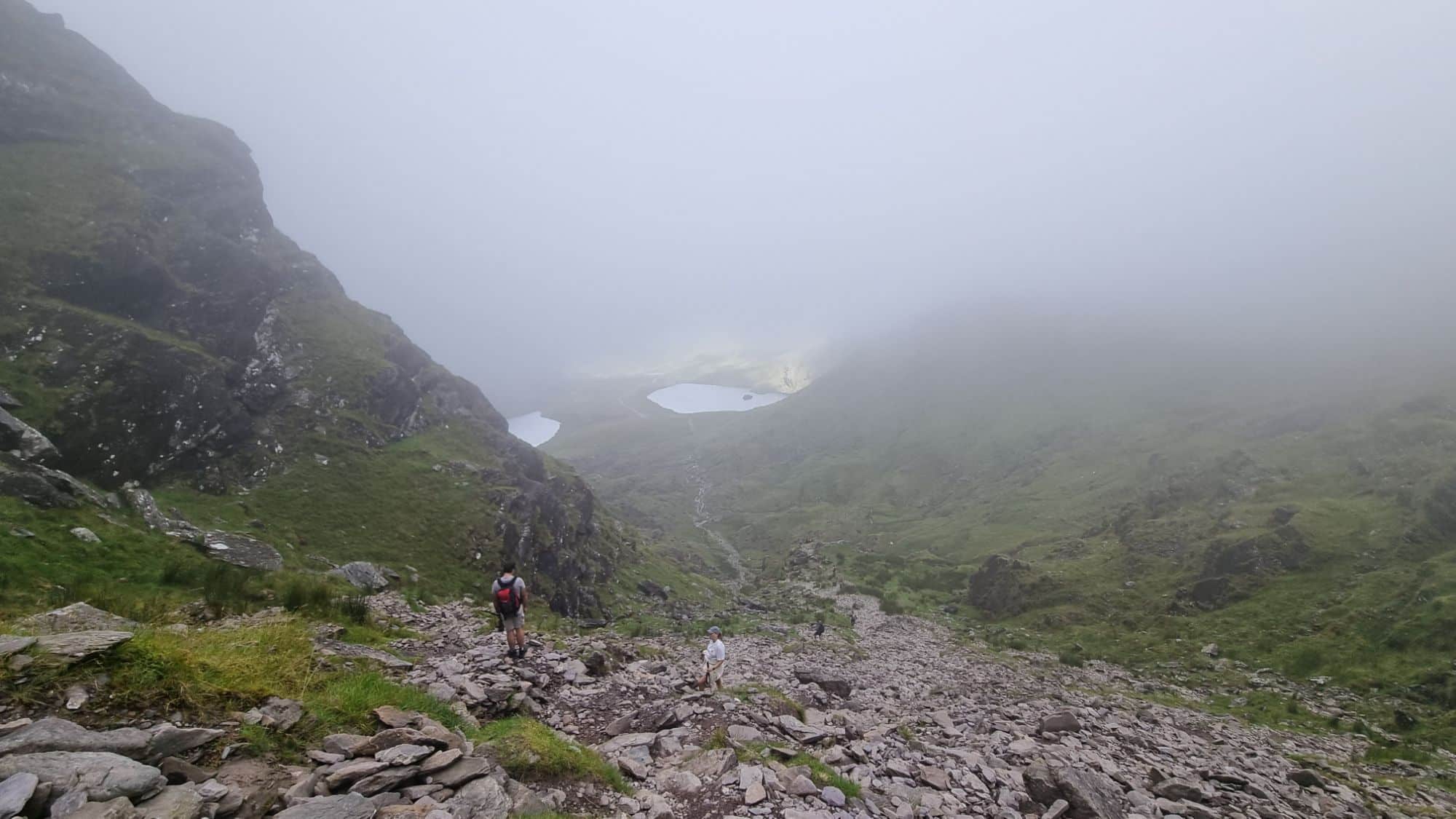
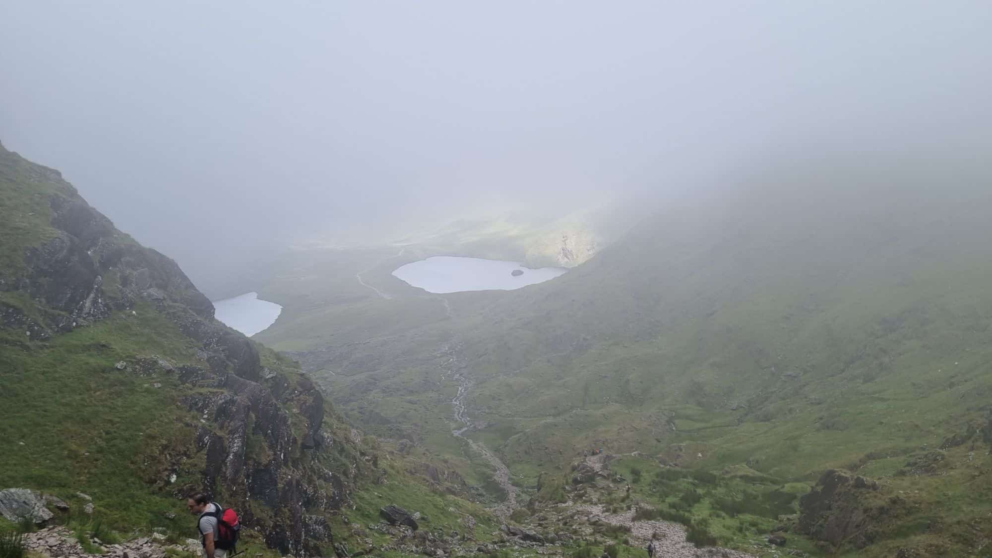
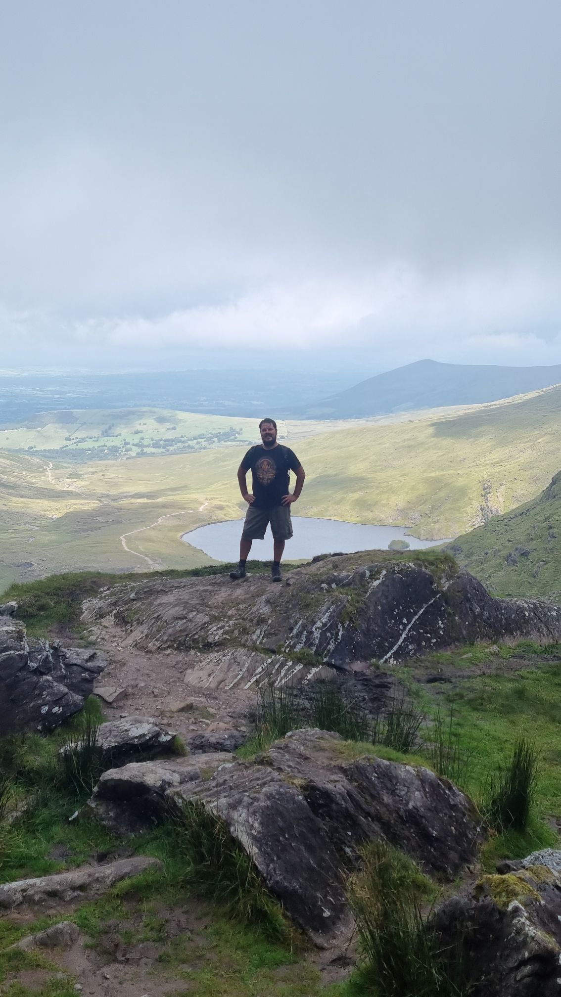
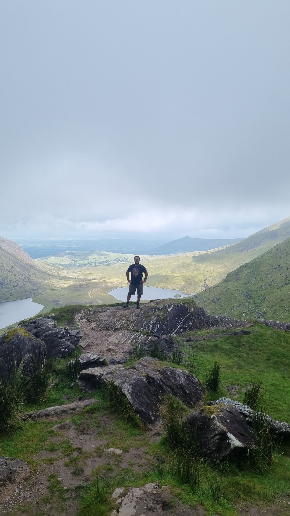
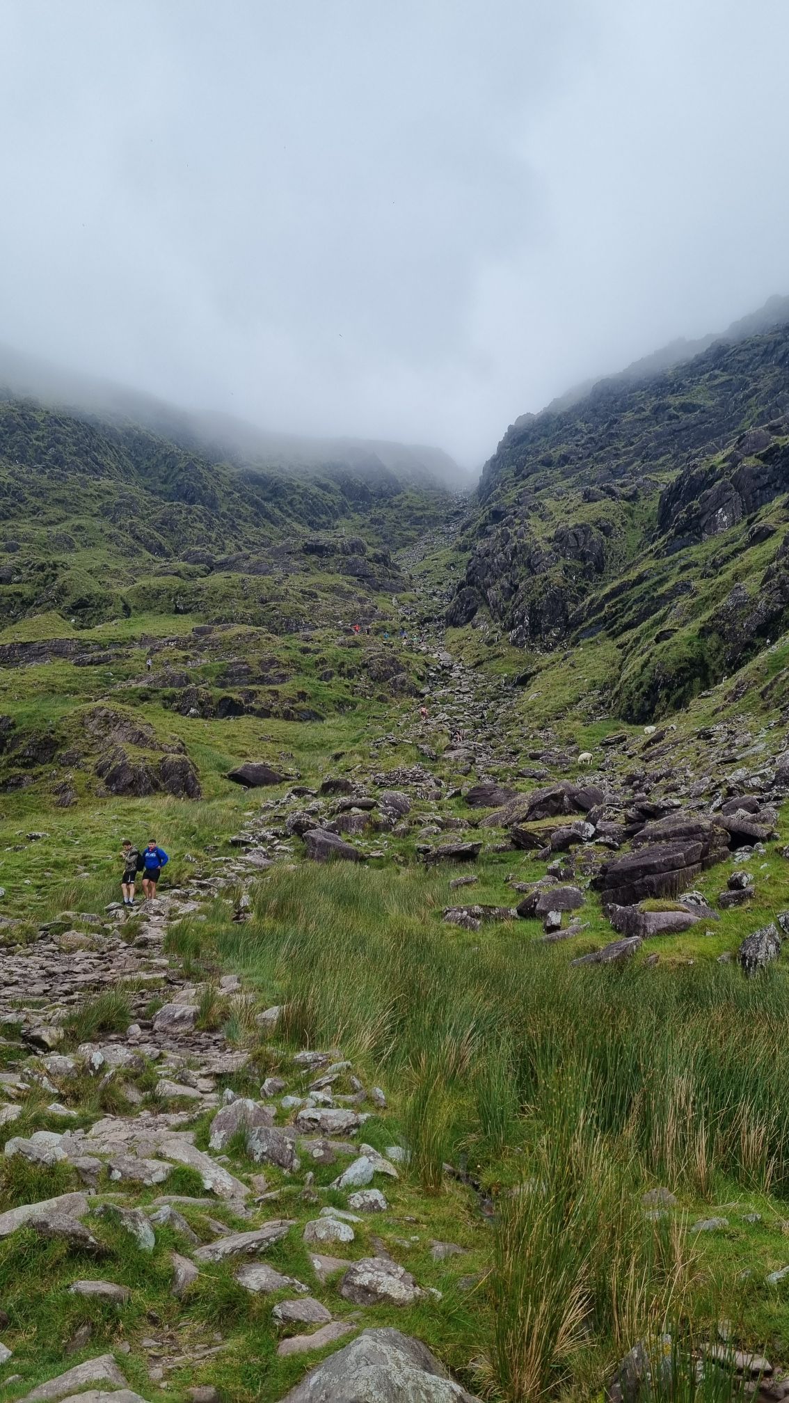
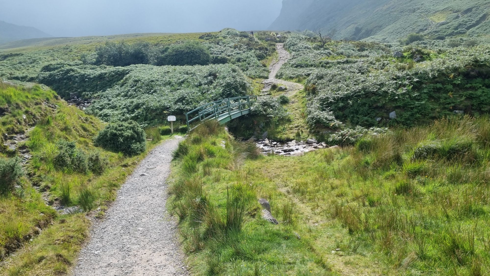
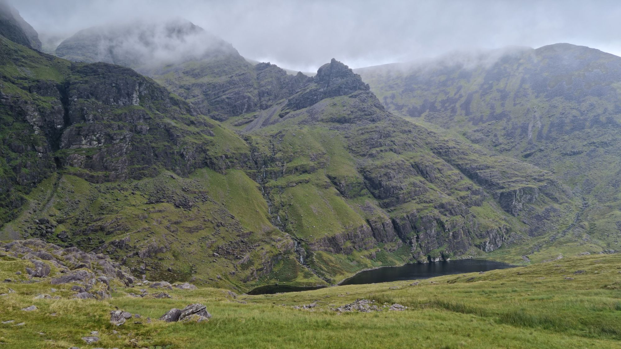
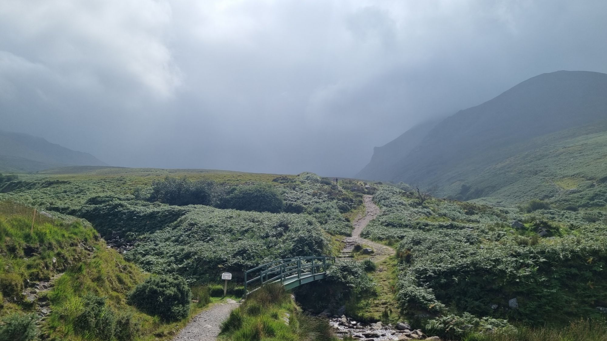
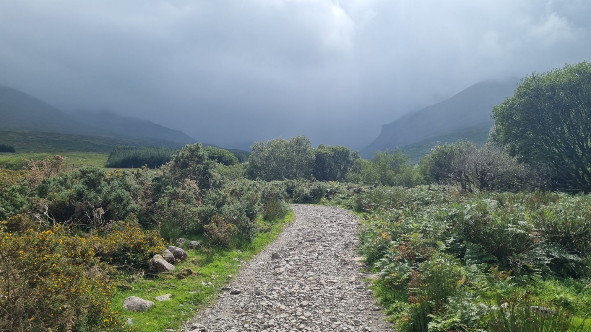
The beginning was lovely — a gentle 30-minute stroll along a path leading through a valley between some stunning mountains. Further in, I passed two incredible lakes, with the trail running between them. Then came a steep sloping gully where water trickled over rocks and mud — known as The Devil’s Ladder. A proper climb, treacherous with plenty of slip hazards and loose rock. It looked foreboding, but I’d set myself the challenge, so it was one foot in front of the other. Soon enough I was using my hands to pull myself over boulders and jagged rock. I avoided looking back too often, but each time I did, I was rewarded with an amazing view.
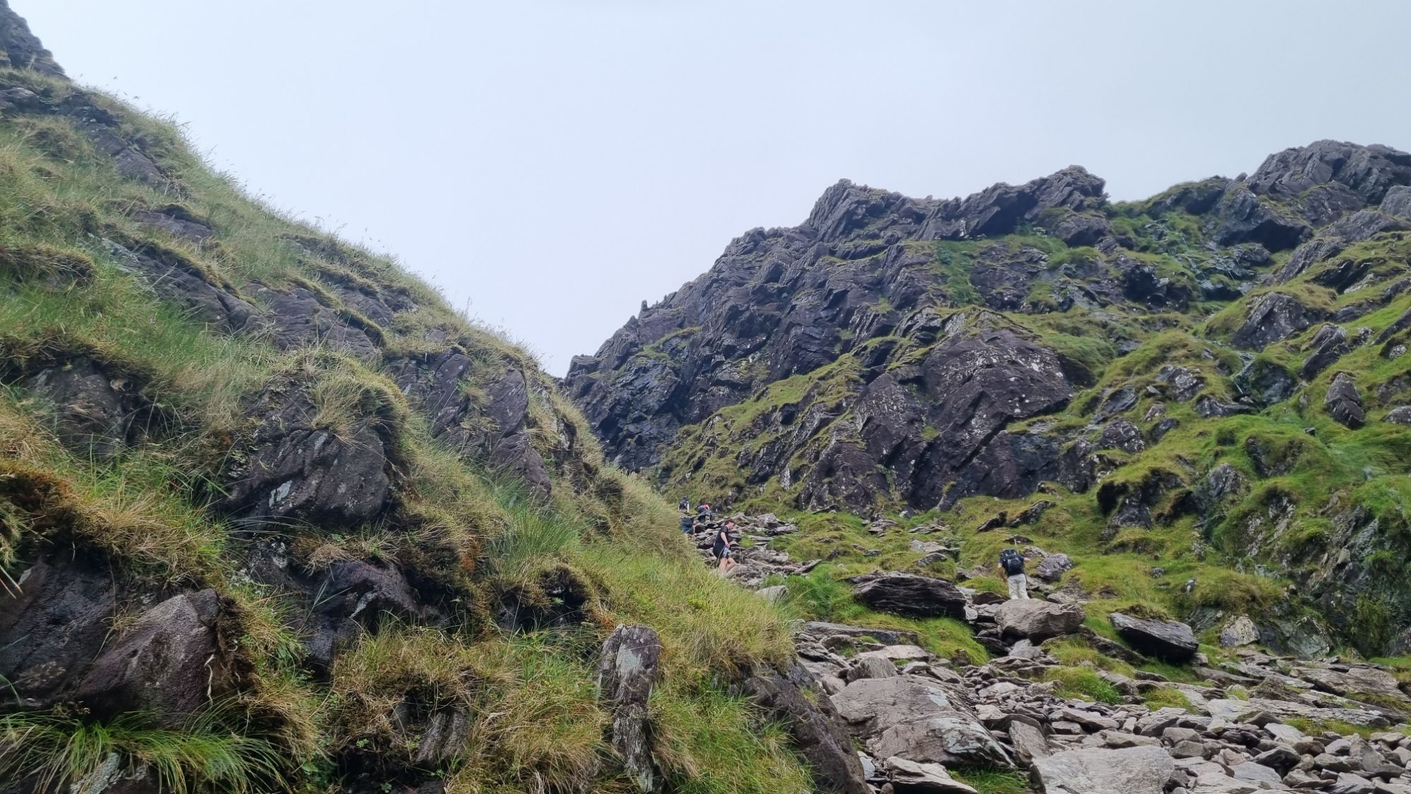
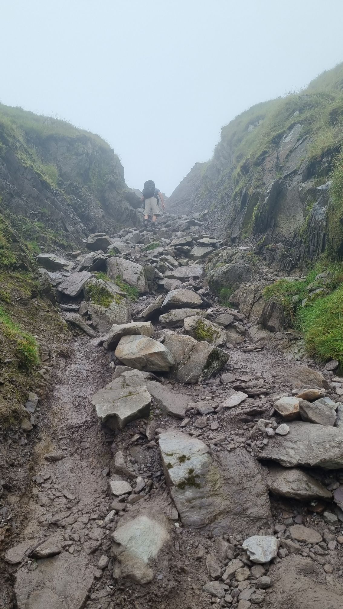
The sight ahead was cloud, and I had no idea how far I had to climb to reach the top. After about an hour, I finally pulled myself up through a muddy trench into the mist and came out onto a flat landing, much relieved. Around 30 people were gathered there, resting or starting their descent. Another hiker with fancy GPS cheerfully informed me I was only halfway.
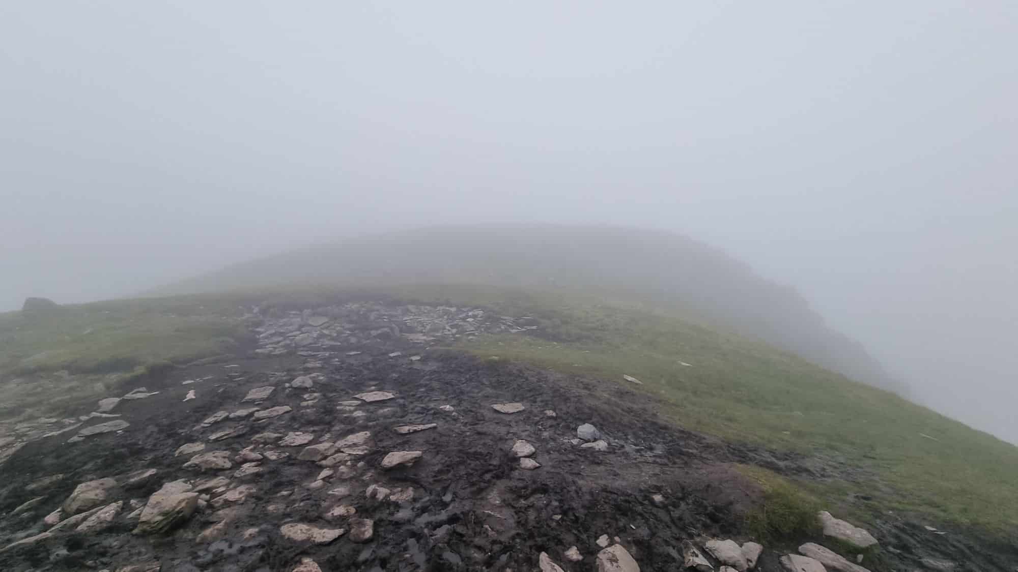
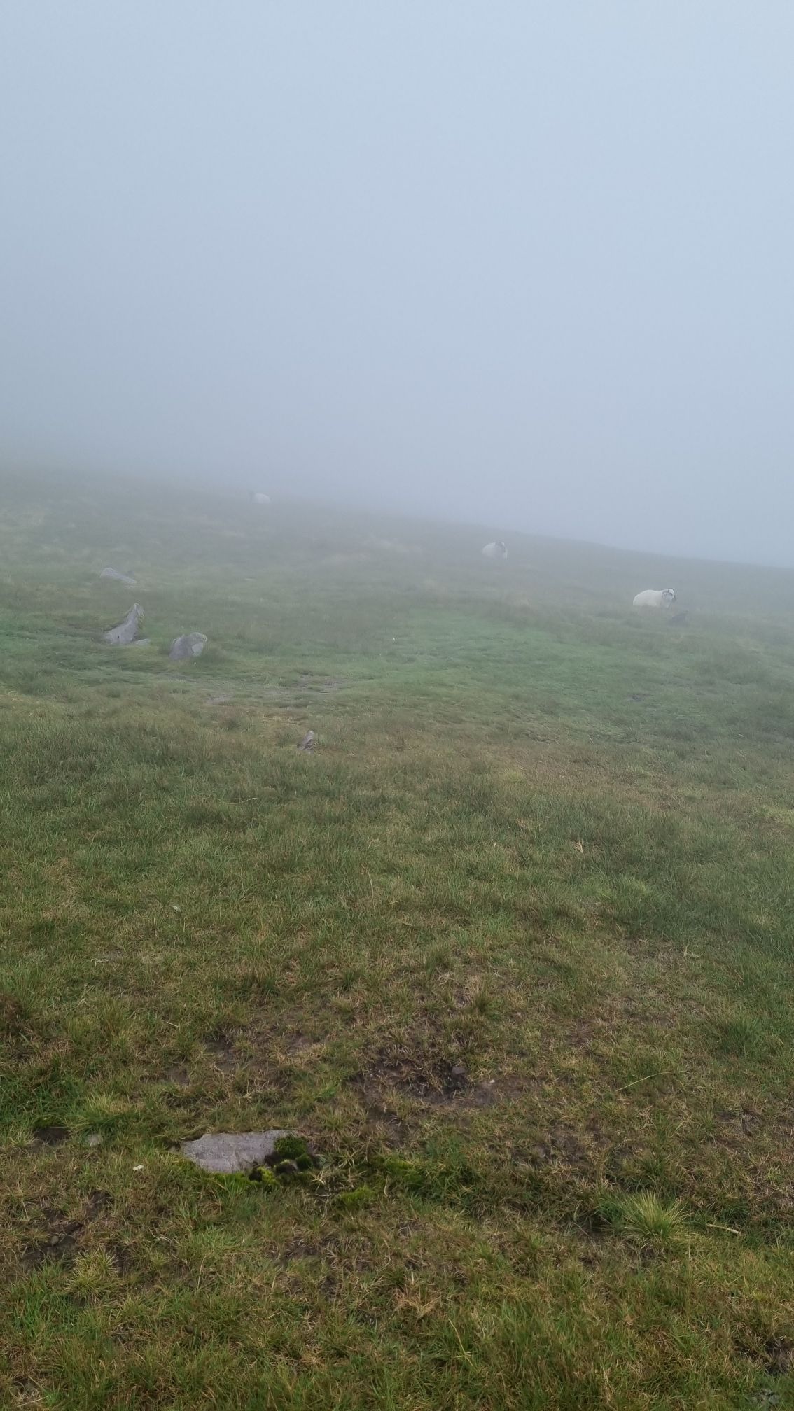
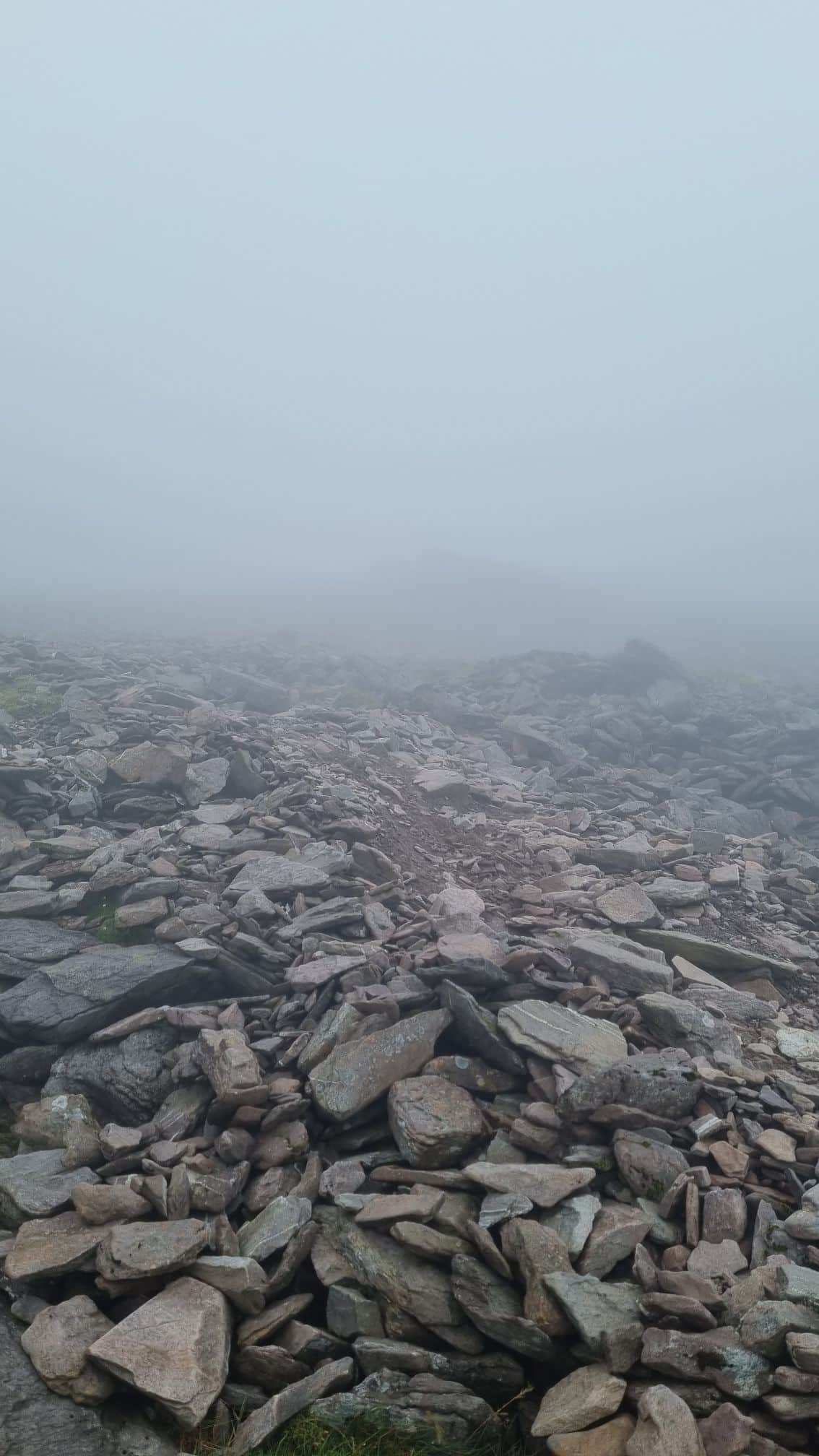
This mountain was so different from the others I’d climbed. My quads and arms were burning from the scramble, rather than my knees and calves feeling the ache. There was no clear path to the summit, which was still hidden in cloud. Trusting my sense of direction, I headed off into the mist. Sure enough, the incline began again, with rocky ground and occasional cairns confirming I was on track.
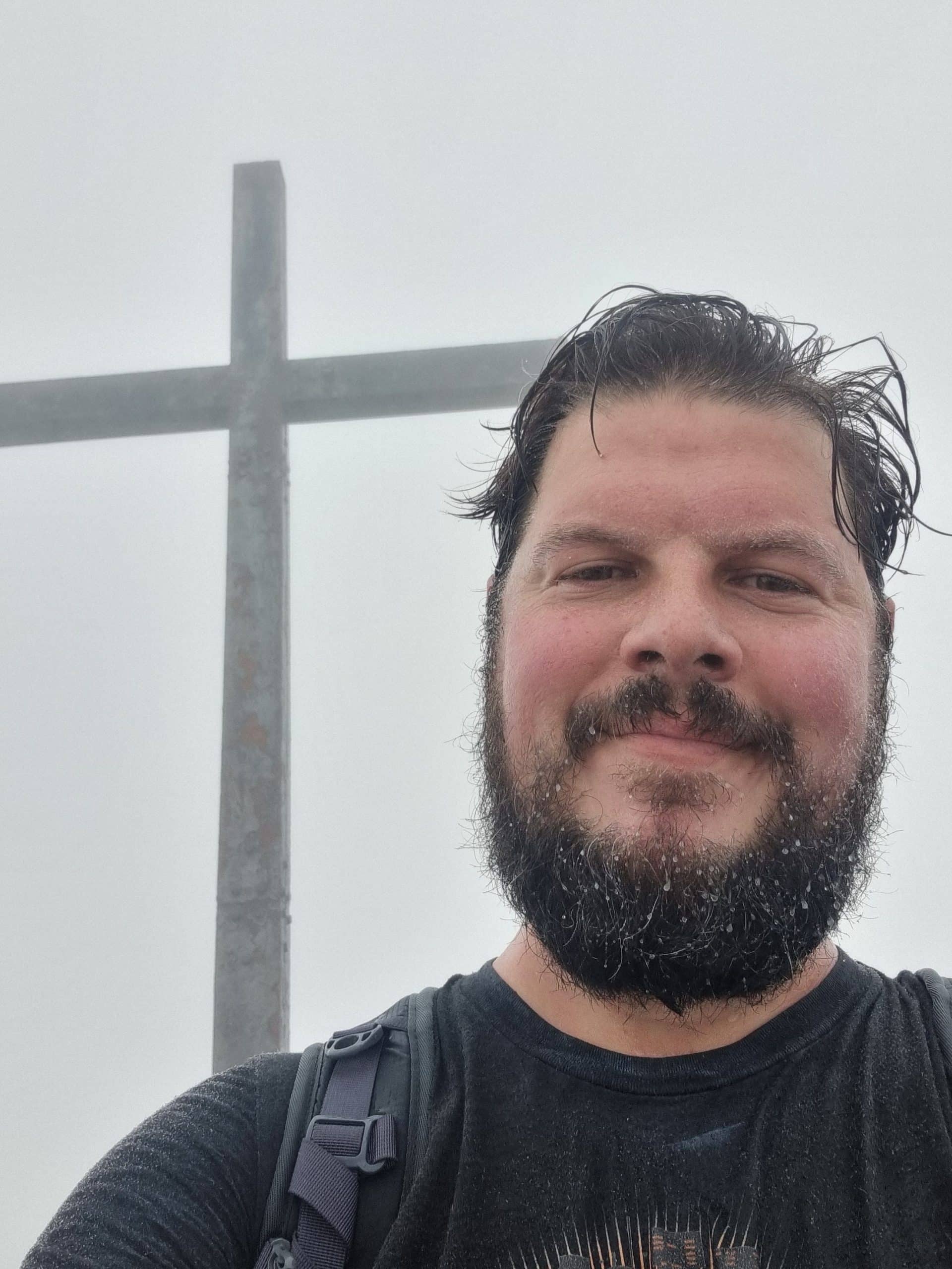
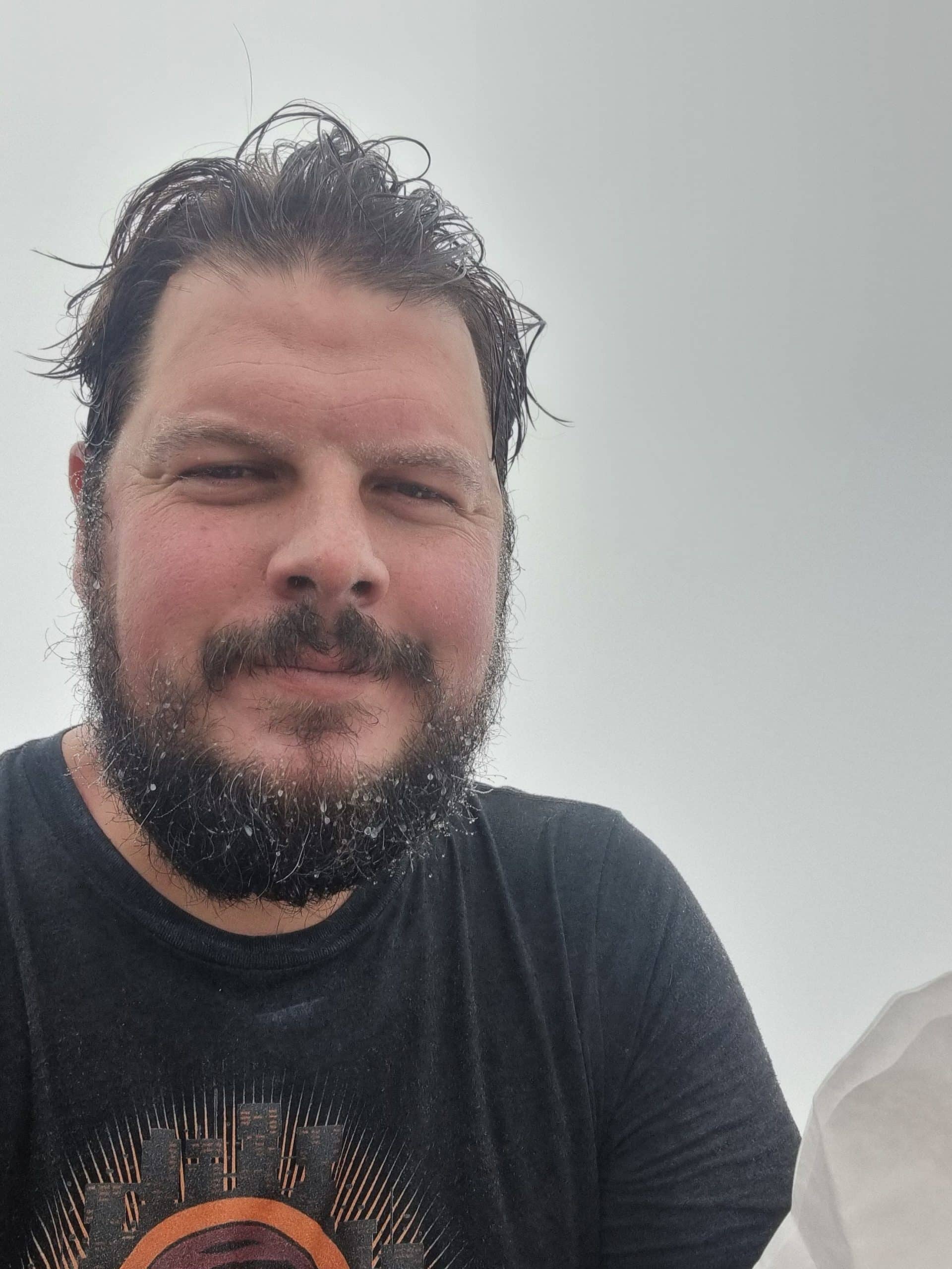
After about 45 minutes, I heard voices ahead and arrived at the summit, where around 20 people were eating lunch and taking photos. I sat down with my own sandwich in hand and took a few photos of my own before psyching myself up for the descent.
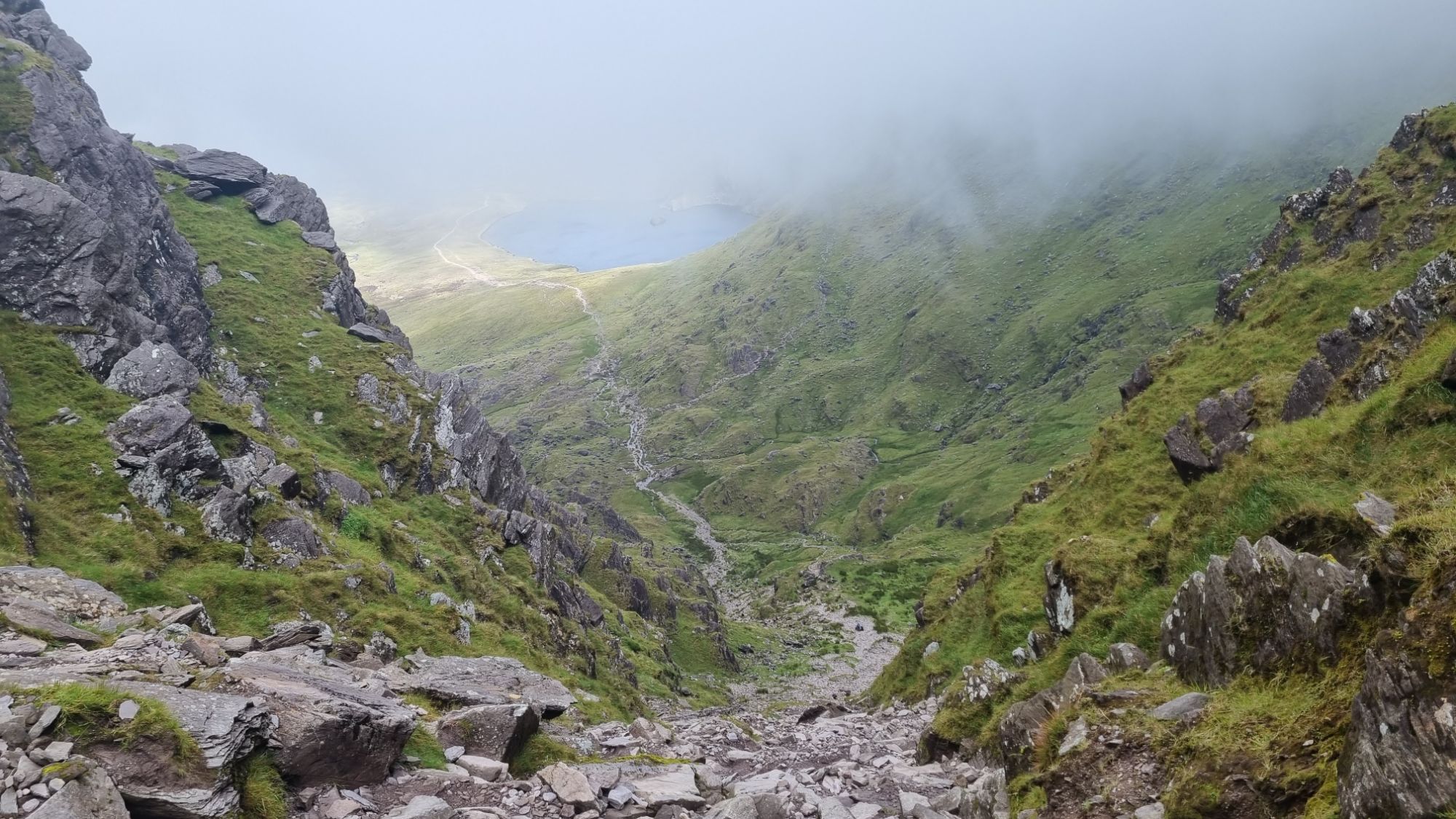
The Devil’s Ladder loomed in my mind, but I had one good idea, I rubbed Voltaren gel on my knees before setting off down the mountain. It worked a charm! I scrambled down towards the landing above the gully, the path still shrouded in cloud. There was talk of an easier zig-zag path down another ridge avoiding the ladder, but it would add an extra hour to the trek. I debated for all of two minutes before deciding it would make a better story to descend the Ladder.
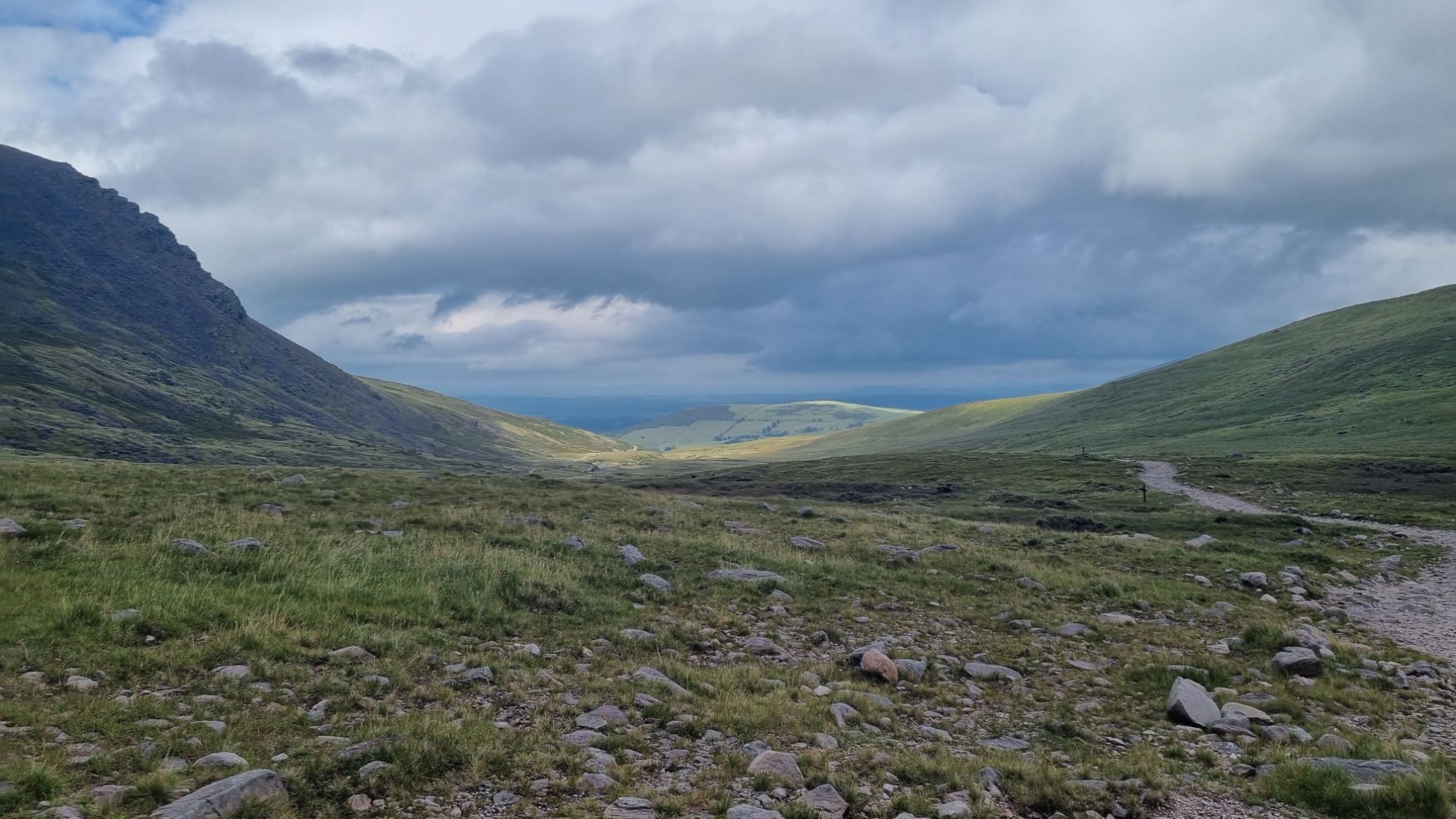
It wasn’t as bad as I’d imagined. I slid down the muddy trench, then, once I was below the cloud line, took extra care with each step. I slid down on my backside in places, or wedged myself between boulders to lower myself in control. Slowly but surely, I made it back to flat ground. Finally, I was following the stream bed back to the easy path through the valley and on to the car.
Another mountain done, and just in time. As I reached the café, I turned to see the mountains disappearing into dark rainclouds.
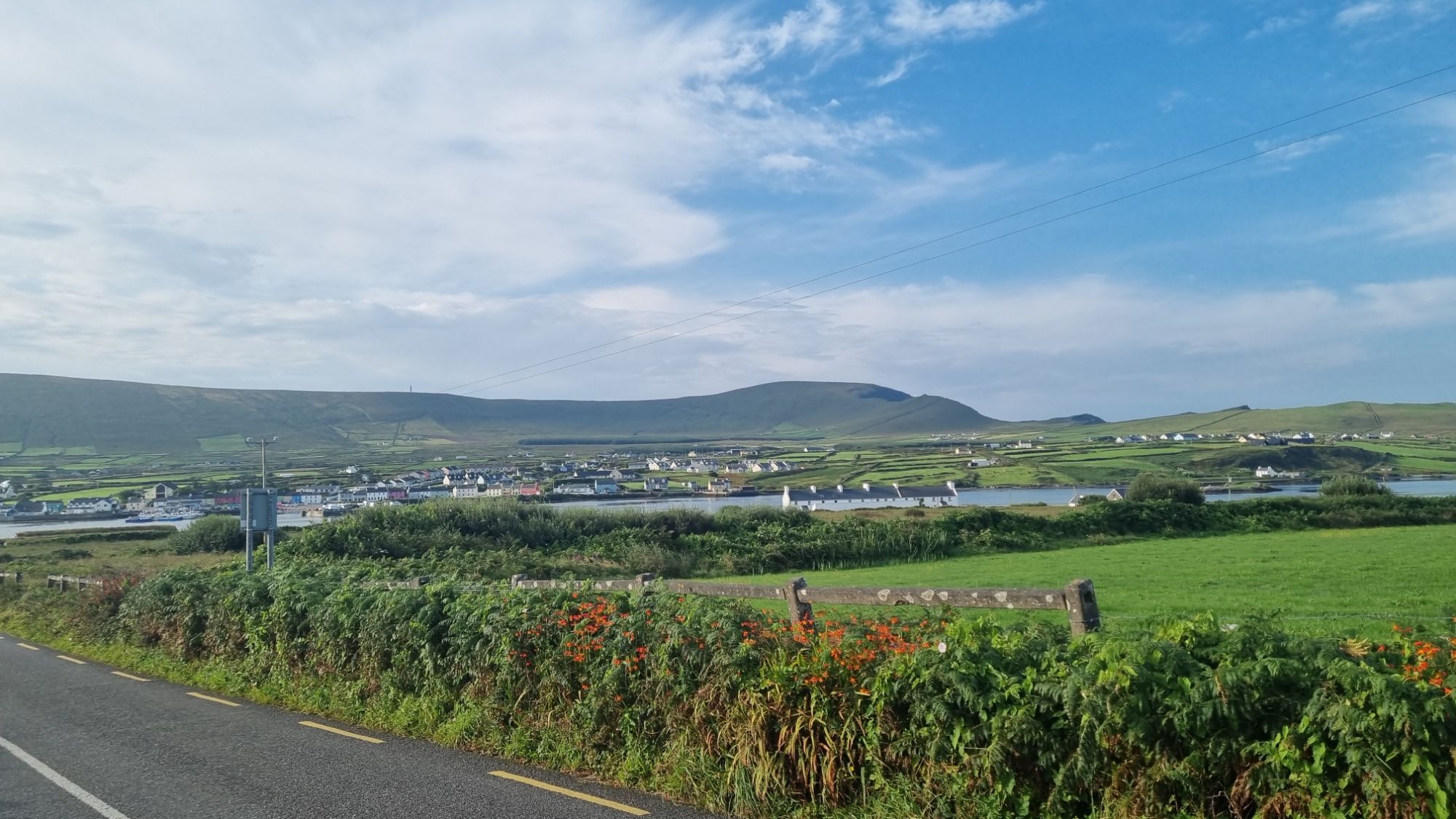
Pleased with myself, I drove towards Portmagee. I was muddy, sweaty, and gross, I didn’t care… though it did make me skip exploring the Puck Fair in Killorglin, which was in full swing as I passed through the town. I was destined for a hot shower and a pub meal.
What I didn’t realise was that, aside from there being the Puck Fair in Killorglin, this was also the busiest time of year for Portmagee! The Portmagee Regatta was on and the place was packed. I had to drive at a crawl across the bridge to Valentia Island, where my accommodation was, it was lined with supporters cheering on the rowers.
I finally got to check in, have a shower, and then walked back across the bridge into Portmagee, weaving through the crowds to the pub. One good thing about travelling solo: there’s almost always a single seat left at the bar. I managed to score the last one in the entire pub. Guinness in hand, seafood chowder in front of me, sat in a seat where Mark Hamill learned to pour a Guinness. I was content. What a day!
Next up: my return to Skellig Michael… I finally get to land on the island! (And amazingly, my knees are still good.)